We use cookies on this site to enhance your user experience
By clicking the Accept button, you agree to us doing so. More info on our cookie policy
We use cookies on this site to enhance your user experience
By clicking the Accept button, you agree to us doing so. More info on our cookie policy
Published: Apr 10, 2024 by
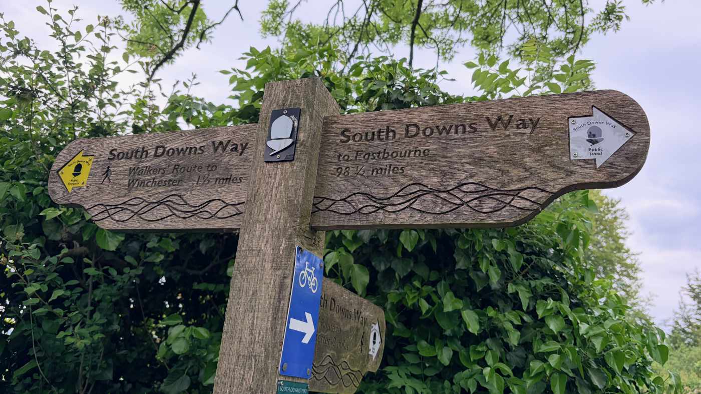
Walking the ridgeway national trail
Read all about my adventures walking the ridgeway in April 2024
Ridgeway day 5 - Near Watlington to Princess Risborough - 12.5 miles
Watlington was quite a charming little village the first time we drove through it, but after driving back and forth doing the car shuffle we realised it would probably be better if there was a bypass of some sort. The streets were very narrow and couldn’t really cope with the large 4x4’s driving through it.
Anyway, after a good sleep and a nice shower, and a couple of paracetamol, my foot felt a bit better so I decided to go for it and carry on with the walk. I could always stop earlier at Chinnor or Princess Risborough and wait to get picked up later in the day.
We parked up in the layby near Watlington and started walking along the Icknield Way towards the M40. The ridgeway seemed to follow the Icknield way on and off for most of the day. This section of the ridgeway helped demonstrate the difference in philosophy between the western and eastern sides. We walked alongside the ridge and under the M40 rather than walking along the top of the ridge at this point. It felt a bit strange seeing the hill, but not being on top of it. It makes logical sense, but felt different to what we had become accustomed to.
Unlike the A34 tunnel, the tunnel under the M40 seemed quite plain and boring, with no murals. The path was quite wide in places, with trees on either side, but it was also quite muddy, requiring us to take some shortcuts through the trees around the worst of the mud.
We stopped for a snack, sitting on some felled trees, before the weather took a slight turn for the worse and started to drizzle a bit. We considered walking into Chinnor, but it would have added quite a distance onto the route, so we decided to try a pub nearer to the ridgeway, just outside Bledlow, then see if the rain went away.
The pub was lovely and gave us some time for our gear to dry a bit. We left the pub and looked up at the sky, trying to be positive that it had brightened up. The rain had different ideas and instead it rained harder than before. To be honest, we had done well to not have any rain until the 5th day on the ridgeway (6th day overall on our trip including Avebury).
The path back up to the ridgeway from the pub was a fairly steep chalky path, made even more slippery by the recent rain. At least when we were back on the ridgeway it was a bit more sheltered by the trees, until the path carried on into open fields.
The ridgeway entered some woodland again and climbed up Lodge Hill. This was the only point on our trip where the route was slightly confusing. All the way along the path had been well signposted, but on the other side of the hill it seemed that the path was marked straight through a gate, when it actually went left and down the hill.
Anyway, it was good to be back on top of a hill once more, even though it was a short stint. The rain had now subsided and we see the view once more.
We followed the path across a level crossing and above a train tunnel and across some fields. The next couple of miles were less attractive, walking along the edge of roads before walking along the busy and noisy A4010 towards Princess Risborough. This was one of the worst sections of the route, but it made it all the sweeter when we turned off it and back onto a small track once more.
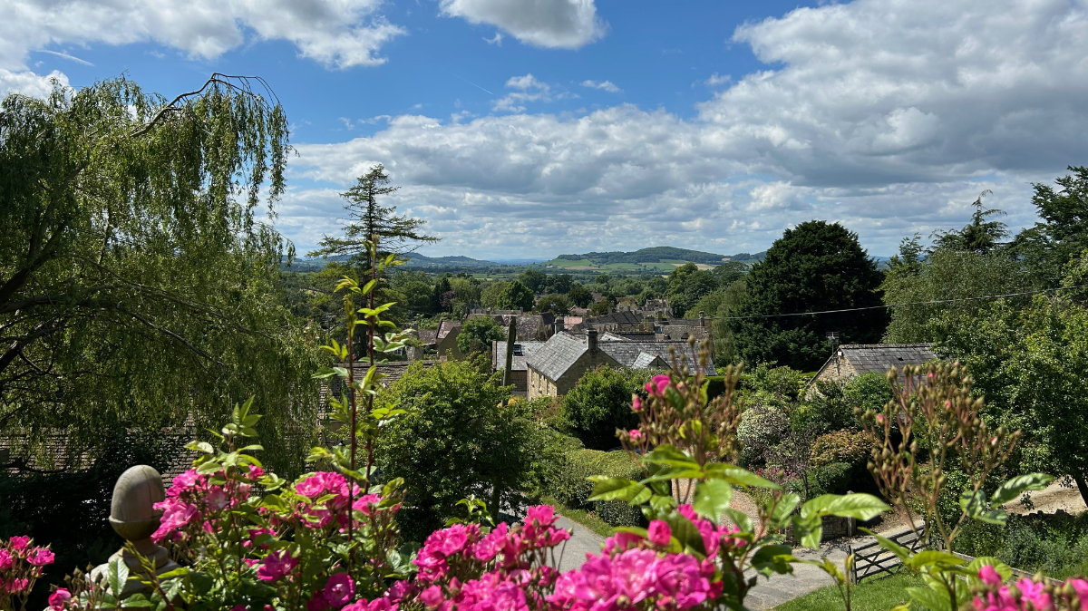
The track took us around the outskirts of Princess Risborough before heading back uphill once more, up Brush Hill towards Whiteleaf Hill car park, ending the day on a high, literally. We stopped at the top of the hill and turned around to admire the view. We could see Lodge Hill in the distance and the hills near Chinnor that we had walked previously. There is something special about seeing how far you have come.
We drove to Hill Farm campsite near Wendover Woods, planning on having a BBQ, but the weather had turned cold, windy and foggy. At this point I was feeling very tired and my feet were hurting. I was so glad that I wasn’t on my own and had my brother’s there for support.
Share
Latest Posts
Every year a small group of us like to plan a long weekend getaway. In previous years we have visited the Peak District, walked a part of the Cotswold Way and even walked the Ridgeway (that time over a full week). This year we decided we wanted to try doing a bit of thru-hiking, but we weren’t quite ready to carry a tent and all the camping gear too, so thought we would arrange places to stay along the way.

I was looking online for ways of having some kind of route displayed on my Apple Watch as I was walking. The built in workouts app allows you to track a lot of information, such as distance, elevation, heart rate, etc. but it doesn’t show you a map of where you have been, are, or are heading to. I noticed that the OS Maps app has an Apple Watch app, so I thought I would give that a go and see what it does.
We were looking at the National trails website and saw the Cotswold Way wasn’t too far away from Brackley. We decided to walk a section but wanted a way of parking at the end of the section and some way of getting to the start. After looking at our map, we discovered the Gloucestershire Warwickshire Steam Railway (GWSR).